This is an interactive map! Use controls to pan and zoom this map.
- Favourite
-
Please login to use this tool.
No account yet? Register first; it's free!
|
Take a boat to Ollie's and instead of turning into the bay travel further North about 10 minutes or so. You can see on the gps, there's a little thing that looks like a pipline in the water. it's at the end of the pipeline. It's in the middle of the ocean. There's like a little bit of a rock mountain out there. the waves break on both North and south side of the pipeline (or what ever it was) and sort of do a big clap at the end. It was about 5 feet at the biggest. but fun. Better than 5 foot Ollies with 20 kooks. you maybe have to ask extra nice for your skipper to bring you there. It's not much further than Ollies,
English (Translate this text in English): Take a boat to Ollie's and instead of turning into the bay travel further North about 10 minutes or so. You can see on the gps, there's a little thing that looks like a pipline in the water. it's at the end of the pipeline. It's in the middle of the ocean. There's like a little bit of a rock mountain out there. the waves break on both North and south side of the pipeline (or what ever it was) and sort of do a big clap at the end. It was about 5 feet at the biggest. but fun. Better than 5 foot Ollies with 20 kooks. you maybe have to ask extra nice for your skipper to bring you there. It's not much further than Ollies,
English (Translate this text in English): Take a boat to Ollie's and instead of turning into the bay travel further North about 10 minutes or so. You can see on the gps, there's a little thing that looks like a pipline in the water. it's at the end of the pipeline. It's in the middle of the ocean. There's like a little bit of a rock mountain out there. the waves break on both North and south side of the pipeline (or what ever it was) and sort of do a big clap at the end. It was about 5 feet at the biggest. but fun. Better than 5 foot Ollies with 20 kooks. you maybe have to ask extra nice for your skipper to bring you there. It's not much further than Ollies,
English (Translate this text in English): Take a boat to Ollie's and instead of turning into the bay travel further North about 10 minutes or so. You can see on the gps, there's a little thing that looks like a pipline in the water. it's at the end of the pipeline. It's in the middle of the ocean. There's like a little bit of a rock mountain out there. the waves break on both North and south side of the pipeline (or what ever it was) and sort of do a big clap at the end. It was about 5 feet at the biggest. but fun. Better than 5 foot Ollies with 20 kooks. you maybe have to ask extra nice for your skipper to bring you there. It's not much further than Ollies,
|
|
Alternative name Gnardog Reef
, ,
Looks like if you went when the swell are coming in consistently at 6+feet. I could be a jem of a wave. It was about 4-5 feet (max) when i was there with three friends. My memory sort of evades me, there's a pipeline that goes all the way out to a big rock or little mountain . It's coral along what ever structure it is that goes out to the island. you can see it on the GPS. there's a right on the south side of the pipeline and a left on the North side of the pipeline. and they clap into one another. But other than the pipeline it's about 20 feet deep. Lots of fish, cool to get some underwater shots.
English (Translate this text in English): Looks like if you went when the swell are coming in consistently at 6+feet. I could be a jem of a wave. It was about 4-5 feet (max) when i was there with three friends. My memory sort of evades me, there's a pipeline that goes all the way out to a big rock or little mountain . It's coral along what ever structure it is that goes out to the island. you can see it on the GPS. there's a right on the south side of the pipeline and a left on the North side of the pipeline. and they clap into one another. But other than the pipeline it's about 20 feet deep. Lots of fish, cool to get some underwater shots.
English (Translate this text in English): Looks like if you went when the swell are coming in consistently at 6+feet. I could be a jem of a wave. It was about 4-5 feet (max) when i was there with three friends. My memory sort of evades me, there's a pipeline that goes all the way out to a big rock or little mountain . It's coral along what ever structure it is that goes out to the island. you can see it on the GPS. there's a right on the south side of the pipeline and a left on the North side of the pipeline. and they clap into one another. But other than the pipeline it's about 20 feet deep. Lots of fish, cool to get some underwater shots.
English (Translate this text in English): Looks like if you went when the swell are coming in consistently at 6+feet. I could be a jem of a wave. It was about 4-5 feet (max) when i was there with three friends. My memory sort of evades me, there's a pipeline that goes all the way out to a big rock or little mountain . It's coral along what ever structure it is that goes out to the island. you can see it on the GPS. there's a right on the south side of the pipeline and a left on the North side of the pipeline. and they clap into one another. But other than the pipeline it's about 20 feet deep. Lots of fish, cool to get some underwater shots.
cool vibe, i'm sure people have surfed there before me, but you definitely feel like you could be the first one when you get out there. Maybe some big fish too, who knows.
English (Translate this text in English): cool vibe, i'm sure people have surfed there before me, but you definitely feel like you could be the first one when you get out there. Maybe some big fish too, who knows.
English (Translate this text in English): cool vibe, i'm sure people have surfed there before me, but you definitely feel like you could be the first one when you get out there. Maybe some big fish too, who knows.
English (Translate this text in English): cool vibe, i'm sure people have surfed there before me, but you definitely feel like you could be the first one when you get out there. Maybe some big fish too, who knows.
fun time, watch out for the sharp coral if you eat $h1t.
English (Translate this text in English): fun time, watch out for the sharp coral if you eat $h1t.
English (Translate this text in English): fun time, watch out for the sharp coral if you eat $h1t.
English (Translate this text in English): fun time, watch out for the sharp coral if you eat $h1t.
 Comments
Please login to use this tool.
No account yet? Register first; it's free!
Show all (1)...
Errors, Feedback
You can edit this page to correct errors or add new information. If you have any problems regarding this page, Send us feedback.
 English
 Español
 Français
 Português


 Scardog reef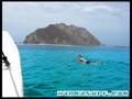

By Kiki , 16-03-2010
- I have been going to Costa Rica for 8 years and every year we a take a trip or two to Ollie's. On March 12, 2010 we headed off to Ollie's and arrived at low tide with waist to chest waves. The boat captain requested to take us to La Isla a/k/a Scardog Reef. When we arrived it was the sketchiest set up I had ever seen from the boat. Once in the water it turned out to be a perfect right hand point break with nice drops and a 100 yard bowl right into a deep channel making for an easy paddle out. It was about head high, maybe bigger on sets. Probably bigger and it would have been epic becuase the wind was light north making it perfectly offshore. At the take off spot the reef is right there. Reminds me of Cane Garden Bay in Tortola